
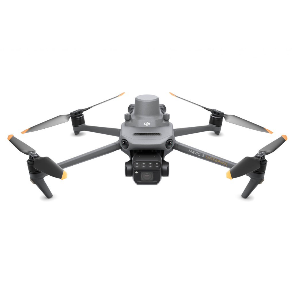
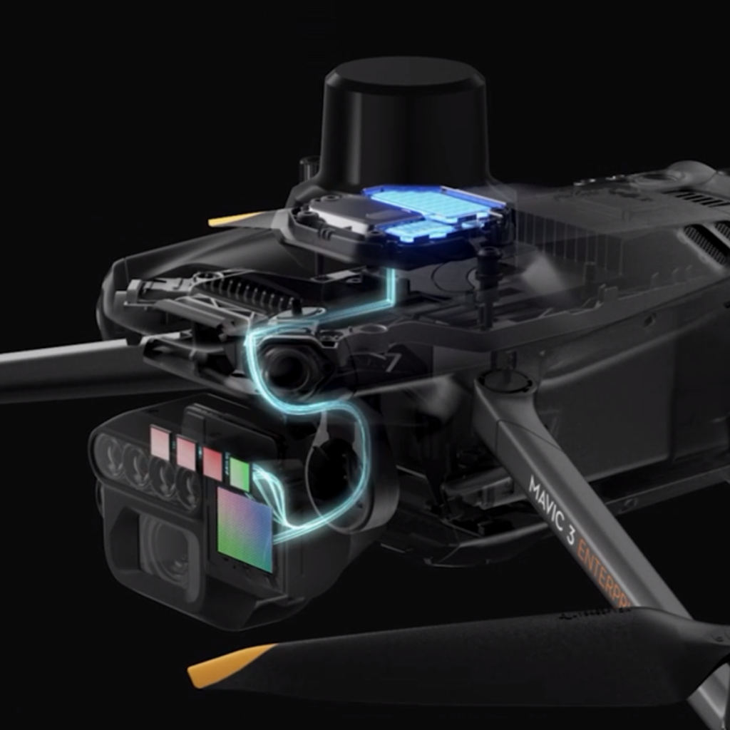



Land survey drone – The DJI Mavic 3M is a high-precision drone built for land surveying and agriculture. It combines an RGB camera with a multispectral sensor to reveal detailed crop and terrain data—helping professionals make smarter, faster decisions in the field.
The Mavic 3M features high-resolution RGB and multispectral cameras, capturing detailed images and data—even things invisible to the naked eye. Ideal for vegetation analysis and environmental monitoring.
With RTK and GPS, it delivers centimeter-level accuracy, essential for mapping and modeling. Its sturdy build ensures stable flight even in tough conditions.
Covers large areas in one flight, reducing the need for repeat trips and saving time on the job.
An intuitive interface and smart planning tools make it simple to fly and collect data—perfect for both pros and beginners.
Mavic 3M allows terrain-follow aerial surveying of orchards, even on sloped landscapes. Together with DJI Terra or DJI SmartFarm Web to reconstruct high-resolution orchard maps, automatically identify the number of trees, distinguish trees from other obstacles or objects, and generate three-dimensional operation routes for agricultural drones, making operations safer and more efficient.
For rice fertilization, cotton growth regulation, and potato foliar fertilizer spraying, the Mavic 3M is used to obtain multi-spectral images of crops. DJI Terra or the DJI SmartFarm Web can then generate NDVI and other vegetation indices maps, capturing differences in crop potential and generating prescription maps that allow agricultural drones to execute variable-rate application. This ultimately allows users to reduce costs, increase yield, and protect the environment.
The Mavic 3M can carry out automatic field scouting. The field scout images can be uploaded to the DJI SmartFarm Web in real time through a 4G network. It can also conduct intelligent analyses, such as cotton seedling identification and rice production testing, for real-time sharing of crop growth information, guidance of agronomic activities, and easy management of 70 hectares of farmland by one person.
The Mavic 3M can also be used in environment and natural resource surveys, such as water enrichment monitoring, forest distribution surveys, urban green area surveys, and more.
Drones like the DJI Mavic 3M have transformed land surveying by cutting down time and labor. Tasks that once took days can now be done in hours, helping teams stay on schedule and work more efficiently.
Equipped with advanced sensors and cameras, the Mavic 3M captures accurate, high-resolution data essential for reliable survey results. This reduces errors and improves overall project accuracy.
Drones can reach difficult or risky areas—like steep terrain or dense vegetation—without putting surveyors in harm’s way. This makes surveys safer and expands coverage to more locations.
By speeding up work and reducing manual effort, survey drones help lower overall project costs. The Mavic 3M is a smart investment for survey teams looking to save time and money.
At Gennex, we offer more than advanced drones like the DJI Matrice 3M—we provide complete technology solutions. From electronic components and semiconductor tools to scientific equipment, PCB systems, and industrial technologies, we’ve got your needs covered. Whether you’re in agriculture, research, or manufacturing, we also offer a full range of drones tailored for surveying, inspection, mapping, and more.
Talk to our tech experts at: drone@gennexcorp.com
GENNEX SOLUTIONS PHILS., INC.
2nd Flr. CJRS Parkview Building Phase V Blk 116 Lots G&H Rodeo Drive Laguna Belair Subd. Brgy Don Jose Sta Rosa City, Laguna, Philippines 4026
Gennex was founded on March 2000 and since then, we have expanded and established our presence across Southeast Asia, with offices in Singapore, the Philippines, Thailand and Malaysia. This has been achieved through our unwavering efforts to provide our customers with quality products and services.