
Inside the August 2026 Philippine Flood Crisis
A Nation Under Water Again
The Philippines is the first major landmass in the path of the Pacific typhoon belt, absorbing an average of around 20 tropical cyclones every year. In August 2026, that vulnerability was on full display. According to PAGASA, Typhoon Dolphin, though it never made landfall, tracked north of Luzon and dramatically enhanced the Habagat, pulling torrential rains across Luzon, the Visayas, and parts of Mindanao.
The National Disaster Risk Reduction and Management Council (NDRRMC) reported that the combined effects of tropical cyclones Luis and Maymay and the enhanced Habagat had affected more than 752,000 people across nine regions as of August 10, with at least eight confirmed dead and thousands displaced. Other tallies placed the death toll as high as 16 as landslides and flooding continued to claim lives across northern Luzon.
Table of Contents
Which Regions Are Being Hit The Hardest?
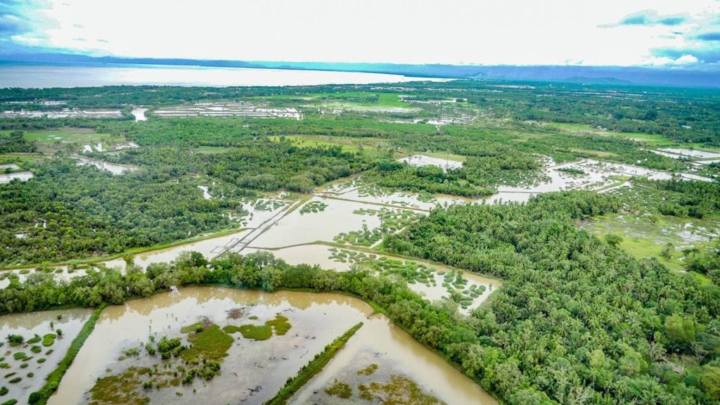
The disaster is not confined to the capital. NDRRMC situation reports identified affected populations across the Ilocos Region, Cagayan Valley, Central Luzon, Bicol, Zamboanga Peninsula, the Cordillera Administrative Region (CAR), Mimaropa, and Calabarzon, with flooding specifically reported in Regions I and III, Mimaropa, CAR, and Calabarzon.
- Baguio and Benguet (CAR): The mountain city of Baguio recorded an astonishing 1,413.2 mm of rain from August 1 to 9, roughly 47% above its typical monthly total, triggering deadly landslides that buried homes.
- Central Luzon (Region III): Severe flooding hit at least 132 villages across six provinces, with roads and a bridge in Bulacan and Pampanga rendered impassable.
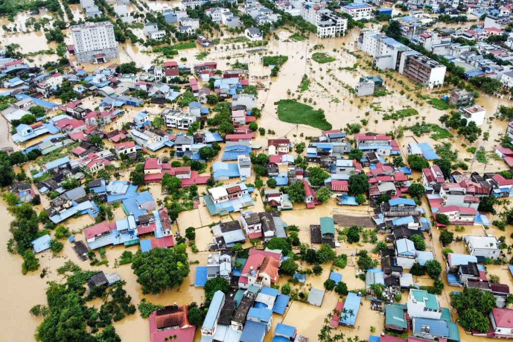
- Metro Manila (NCR): Waist-deep flooding swamped low-lying communities in Quezon City, Las Piñas, and beyond, prompting mass evacuations and class and work suspensions across the capital.
- Western Visayas, Bicol and Southern Tagalog: Rough seas stranded 543 passengers, cargo, and vessels across 28 ports as maritime travel ground to a halt.
Dams at Critical Levels and a Race Against Time
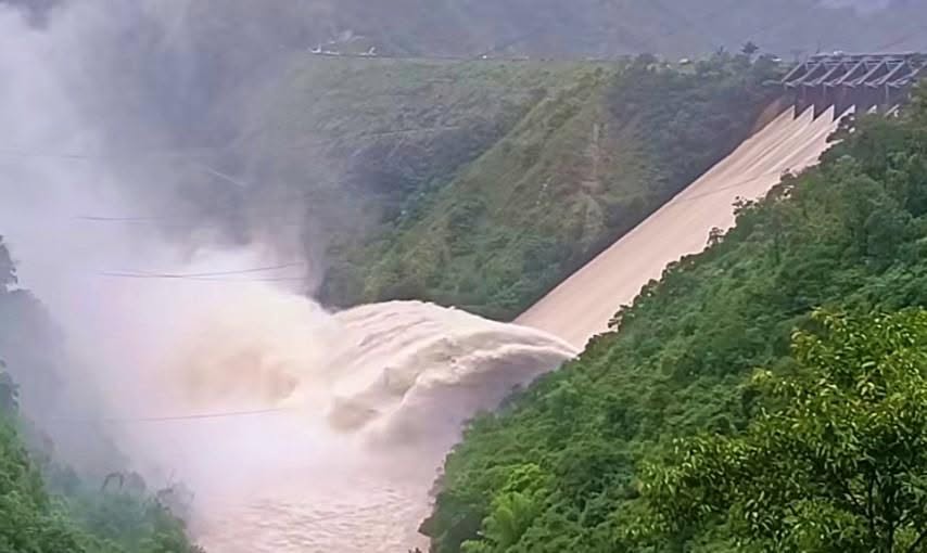
Beyond street flooding, the crisis has pushed the region’s water infrastructure to the edge. Authorities opened all four gates of the Ambuklao and Binga dams in Benguet as reservoirs neared high-water levels, while real-time monitoring flagged the La Mesa Dam and the Marikina River system at critical thresholds, threatening downstream communities in Metro Manila. President Ferdinand Marcos Jr. directed agencies to remain on heightened alert and to carefully coordinate dam water releases to protect communities downstream.
Why the Floods Keep Winning
Each flood season exposes the same structural weaknesses. Public Works Secretary Vince Dizon acknowledged the need to fix “years and decades’ worth of faulty flood mitigation interventions,” a pointed reference to an ongoing national scandal over questionable flood-control projects. Compounding the problem, traditional disaster response still leans heavily on slow, dangerous, ground-based methods:
- Ground surveys are slow and hazardous, delayed by impassable roads, floodwaters, and landslide debris.
- Rescue teams face near-zero visibility at night and unstable, collapsing terrain.
- Damage assessment lags behind the disaster, slowing relief and rehabilitation.
- Officials often lack the real-time, wide-area picture needed to direct resources where they matter most.
Scientists increasingly attribute the intensity of these back-to-back events to a changing climate, warning that heavier rainfall and fiercer storms are becoming the new normal for the archipelago. If the hazard is intensifying, the response must modernize with it.
Drones as a Frontline Flood-Response Solution
Seeing the Whole Picture, Fast
When floodwaters cut off roads and darkness hides survivors, aerial intelligence changes everything. DJI Enterprise drones give responders an instant, wide-area view of a disaster zone, streaming live video to command centers before ground teams can even reach the scene. According to DJI Commercial Drones PH, DJI enterprise drones are engineered to deliver precision, enhanced operational efficiency, and cost-effective data collection through advanced sensors, intelligent flight modes, and real-time data processing. Among its featured industries, the platform highlights Search and Rescue, “Rapid Response When Every Second Counts,” and Government, “Reliable Aerial Solutions for Public Operations.”
This is exactly the capability a flood crisis demands. Where ground teams are blind, drones provide clarity.
How DJI Drones Support Flood Response
CASE STUDY: LiDAR Drones Solve Recurring Floods in Mariveles, Bataan
The clearest proof that drones work against Philippine floods comes from the ground, or rather, the air. In Mariveles, Bataan, every typhoon season brought the same threat: floods that damaged homes, disrupted livelihoods, and put lives at risk. To build a more resilient city, the local government needed accurate data for a comprehensive drainage master plan. Using traditional ground surveys, the work would have required two to three teams and up to four months.
Deploying the DJI Zenmuse L3 LiDAR payload, the same survey was completed in a single day:
- 470 hectares divided into 3 zones and fully surveyed in about 2 hours
- All captured data post-processed in roughly 6 hours
- Flood-prone zones identified with exact coordinates
- Priority infrastructure areas pinpointed for the drainage master plan
The result was high-precision aerial data that gave engineers everything they needed to lay the foundation for an effective drainage master plan, and a more flood-resilient Mariveles. What would have taken months of hazardous fieldwork was accomplished in a single, safe day, precisely the kind of capability every flood-prone Philippine LGU needs this season.
Supporting Case: Search and Rescue During Devastating Floods, Vietnam
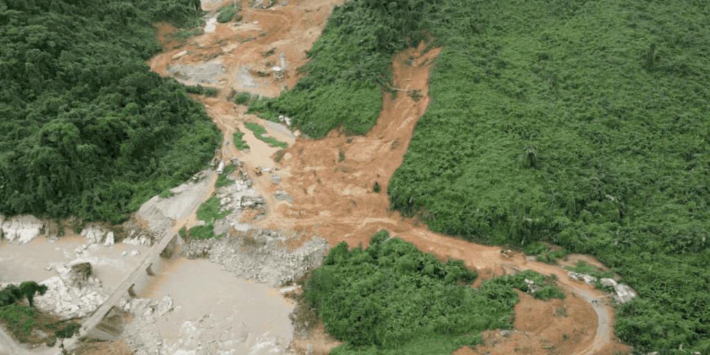
Regional experience reinforces the point. During the catastrophic 2020 monsoon floods and landslides in Central Vietnam, which caused over USD 1.3 billion in damage, DJI Matrice 300 RTK and Mavic 2 Enterprise Dual drones were pressed into service as rescue tools. Equipped with thermal and zoom cameras, they helped teams navigate dense, rain-drenched, landslide-prone terrain to assess damage and locate survivors where ground access had been cut off, underscoring the life-saving role of aerial intelligence in large-scale flood disasters.
From Reacting to Floods to Outstanding Them
The August 2026 floods are a stark reminder that the Philippines cannot afford to face each rainy season with yesterday’s tools. With more than 750,000 people affected in a matter of days, the cost of slow, blind, reactive response is measured in lives and livelihoods. Drones will not stop the rain, but they can transform how the country responds to it, delivering faster awareness, safer rescues, and the precise data needed to finally build lasting flood resilience. As the water rises, aerial intelligence is no longer a luxury. It is fast, becoming a necessity.
Why Source DJI Enterprise Drones from Gennex?
Authorized Distributor for DJI Enterprise
As an authorized distributor of DJI Enterprise products in the Philippines, Gennex provides professional drone solutions tailored for surveying, engineering, and disaster response applications.
For Philippine LGUs, disaster offices, and public-safety teams, the right partner matters as much as the right drone. As an authorized DJI Enterprise provider in the Philippines, Gennex delivers advanced drone solutions for flood monitoring, rapid damage assessment, and disaster response, helping teams make faster, data-driven decisions when every second counts.
FAQs
How can DJI Enterprise drones support flood response operations?
Why are drones valuable during flood emergencies?
Floods can block roads, reduce visibility, and limit ground access. Drones offer a rapid aerial view of affected areas, enabling teams to assess conditions, identify safe routes, and coordinate response efforts more effectively.
How do DJI drones help with flood-risk assessment and mitigation planning?
Are DJI drones suitable for government agencies and disaster response teams?
Yes. DJI Enterprise solutions are designed for public safety, emergency response, search and rescue, and government operations that require reliable aerial intelligence and rapid deployment capabilities.
Which industries can benefit from DJI flood management solutions?
Stay Ahead of Rising Waters with DJI Drones Flood Management Solutions
DJI Enterprise drones deliver real-time aerial intelligence for flood monitoring, search and rescue, damage assessment, and risk mapping. With thermal imaging, drone aerial mapping, LiDAR, and autonomous operations, teams can respond faster, safer, and smarter during flood events.
contact: drones@gennexcorp.com

References
Agence France-Presse. (2026, August 10). Days of heavy rain leave at least 16 dead in Philippines. CNA. https://www.channelnewsasia.com/asia/philippines-heavy-rain-floods-landslides-16-dead-6310201
Araja, R. N., Espiritu, R., & Lopez, V. (2026, August 9). ‘Habagat’ kills 10; affects over 380,000. Manila Standard. https://manilastandard.net/news/weather/314776480/habagat-kills-10-affects-over-380000.html
DJI Enterprise. (2021, January 15). DJI drones assist in Vietnamese search-and-rescue mission during devastating floods & landslides. DJI Enterprise Insights. https://enterprise-insights.dji.com/user-stories/drone-search-and-rescue-vietnam-flood-landslides
DJI Enterprise. (2026, July 5). How LiDAR drones are helping cities in the Philippines solve recurring flood problems: DJI Zenmuse L3. YouTube. https://www.youtube.com/watch?v=TXBMnmp0b7U
DJI Enterprise. (n.d.). Disaster prevention and response. Retrieved August 12, 2026, from https://enterprise.dji.com/public-safety/disaster-prevention-and-response
Esguerra, D. J. (2026, August 9). ‘Habagat,’ storms: Death toll hits 8; 486K affected. Philippine News Agency. https://www.pna.gov.ph/articles/1281431
Laqui, I. (2026, August 10). NDRRMC: 8 dead, 1 missing, due to ‘Luis,’ ‘Maymay,’ habagat. Philstar.com. https://www.philstar.com/headlines/2026/08/10/2548315/ndrrmc-8-dead-1-missing-due-luis-maymay-habagat
Reuters. (2026, August 9). Enhanced monsoon rains due to typhoon Dolphin trigger flooding in PH. ABS-CBN News. https://www.abs-cbn.com/news/weather-traffic/2026/8/9/enhanced-monsoon-rains-due-to-typhoon-dolphin-trigger-flooding-in-ph-1856
Santos, J. (2026, August 8). Typhoon Dolphin enhances ‘habagat,’ brings heavy rains over parts of PH—PAGASA. Manila Bulletin. https://mb.com.ph/2026/08/08/typhoon-dolphin-enhances-habagat-brings-heavy-rains-over-parts-of-phpagasa
Villa, H. P. (2026, August 9). Habagat, Typhoon Dolphin strand 543 passengers, disrupt sea travel. Inquirer.net. https://newsinfo.inquirer.net/2280516/habagat-typhoon-dolphin-strand-543-passengers-disrupt-sea-travel
